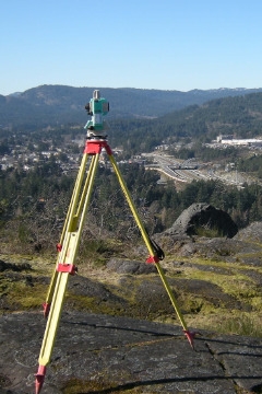
Topographic Survey

Westbrook Consulting Ltd. is a full service engineering firm with two survey crews to allow for work to be completed from initial topographic survey through design to final construction layout and as constructed survey. Prior to the start of design; Westbrook will carry out a topographic survey of the existing infrastructure and/or surface features of the land within the project area.
Features that Westbrook will survey include the following:
- Ground Elevations.
- Storm water infrastructure.
- Sanitary sewer infrastructure.
- Water distribution infrastructure.
- Hydro/Telephone/Cable infrastructure.
- Roads, driveways, sidewalks & curbs and gutters.
- Existing structures such as buildings and fences.
- Trees and prominent bushes.
- Water courses.
- Rock outcrops.
- Banks.
- Other topographic features of significance.
The location and elevation data is collected and downloaded into the AUTOCAD Civil 3D to produce a base drawing, which we use as the basis of our design. Topographic surveys are valuable in order to effectively plan a project and identify any constraints on the proposed works.
Our survey crews have been trained to survey sites with a variety of terrain, from previously developed land, to untouched forested and mountainous areas in a variety of weather conditions.
Westbrook Consulting also provides layout survey services and final as-constructed survey for the purpose of preparing record drawings. For more information on construction survey services please see the Construction Services page.
Please note Westbrook does not provide BC Land Survey services.
